
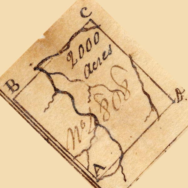
On 24 Mar 1786, Isaac Cox surveyed 2000 acres for John May along the waters of Cedar Creek, a south side tributary of Salt River, that was then located in Nelson County. May obtained a deed to the tract on 24 Apr 1887. We have rotated the plat drawing, shown here, to more closely orient it correctly.
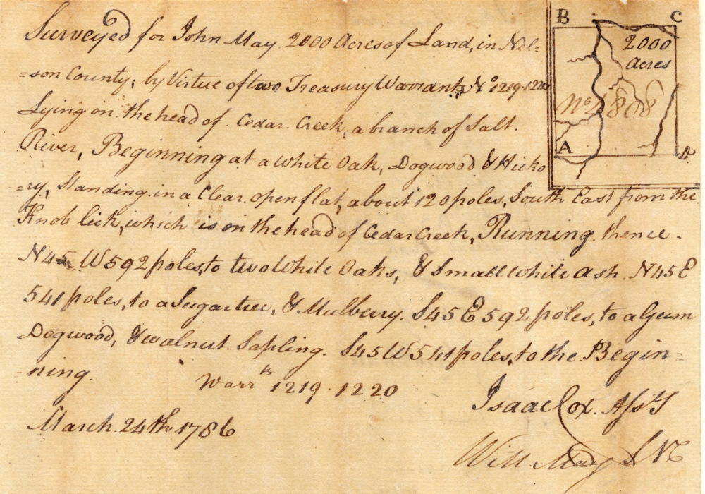
Survey
Surveyed for John May 2000 acres of and in Nelson County by virtue of two treasury warrants No. 1219 & 1220, lying on the head of Cedar Creek, a branch of Salt River, Beginning at a whit oak, dogwood and hickory standing in a clear open flat about 120 poles south east from the Knob lick, which is on the head of Cedar Creek, running thence North 45° West 592 poles to two white oaks and small white ash, North 45° East 541 poles to a sugar tree and mulberry, South 45° East 592 poles to a gum, dogwood and walnut sapling, South 45° West 541 poles to the beginning. March 24th 1786. Isaac Cox, surveyor.
Deed
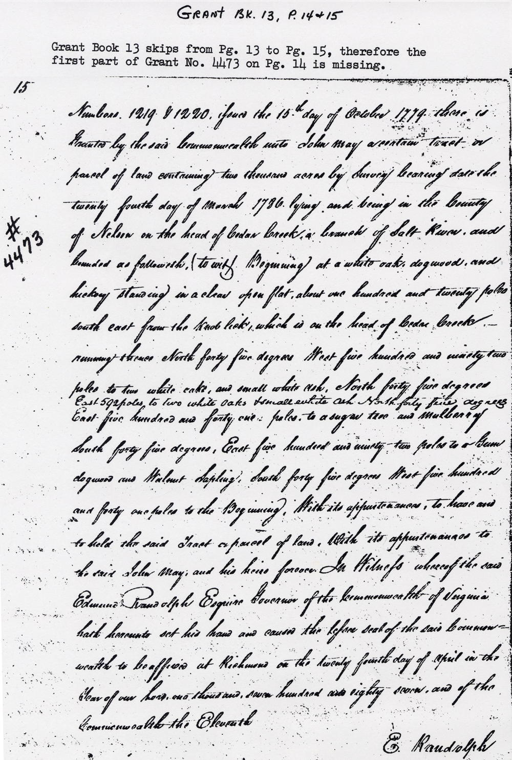
Virginia Grant Book 13, pages 14-15
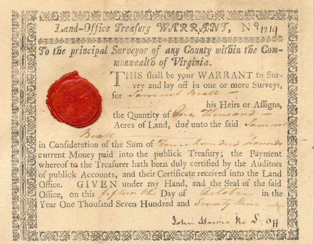
Edmund Randolph Esquire, Governor of the Commonwealth of Virginia. To all to whom these presents shall come, greeting. Know ye that by virtue and in consideration of land office treasury warrant numbers 1219 & 1220 issued the 15th day of October 1779, there is granted by the said Commonwealth unto John May a certain tract or parcel of land containing 2000 acres by survey bearing date the 24th day of March 1786, lying and being in the County of Nelson on the head of Cedar Creek, a branch of Salt River, and bounded as followeth (to wit) Beginning at a whit oak, dogwood and hickory standing in a clear open flat about 120 poles south east from the Knob lick, which is on the head of Cedar Creek, running thence North 45° West 592 poles to two white oaks and small white ash, North 45° East 541 poles to a sugar tree and mulberry, South 45° East 592 poles to a gum, dogwood and walnut sapling, South 45° West 541 poles to the beginning with its appurtenances, to have and to hold the said tract or parcel of land with its appurtenances to the said John May and his heirs forever. In witness whereof the said Edmund Randolph Esquire, Governor of the Commonwealth of Virginia, hath hereunto set his hand and caused the lesser seal of the said Commonwealth to be affixed at Richmond on the 24th day of April in the year of our Lord 1787, and of the Commonwealth the 11th. (signed) E. Randolph
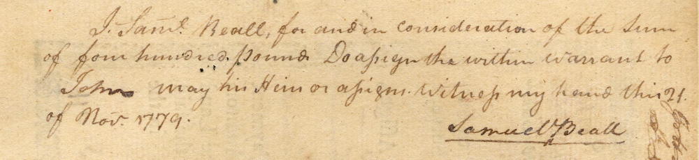
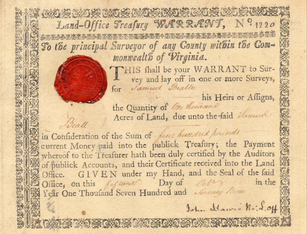
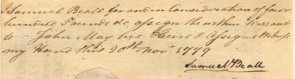
Warrants
If you, the reader, have an interest in any particular part of our county history, and wish to contribute to this effort, use the form on our Contact Us page to send us your comments about this, or any Bullitt County History page. We welcome your comments and suggestions. If you feel that we have misspoken at any point, please feel free to point this out to us.
The Bullitt County History Museum, a service of the Bullitt County Genealogical Society, is located in the county courthouse at 300 South Buckman Street (Highway 61) in Shepherdsville, Kentucky. The museum, along with its research room, is open 10 a.m. to 4 p.m. Monday through Friday. Saturday appointments are available by calling 502-921-0161 during our regular weekday hours. Admission is free. The museum, as part of the Bullitt County Genealogical Society, is a 501(c)3 tax exempt organization and is classified as a 509(a)2 public charity. Contributions and bequests are deductible under section 2055, 2106, or 2522 of the Internal Revenue Code. Page last modified: 12 Jan 2024 . Page URL: bullittcountyhistory.org/bchistory/4473-may.html