
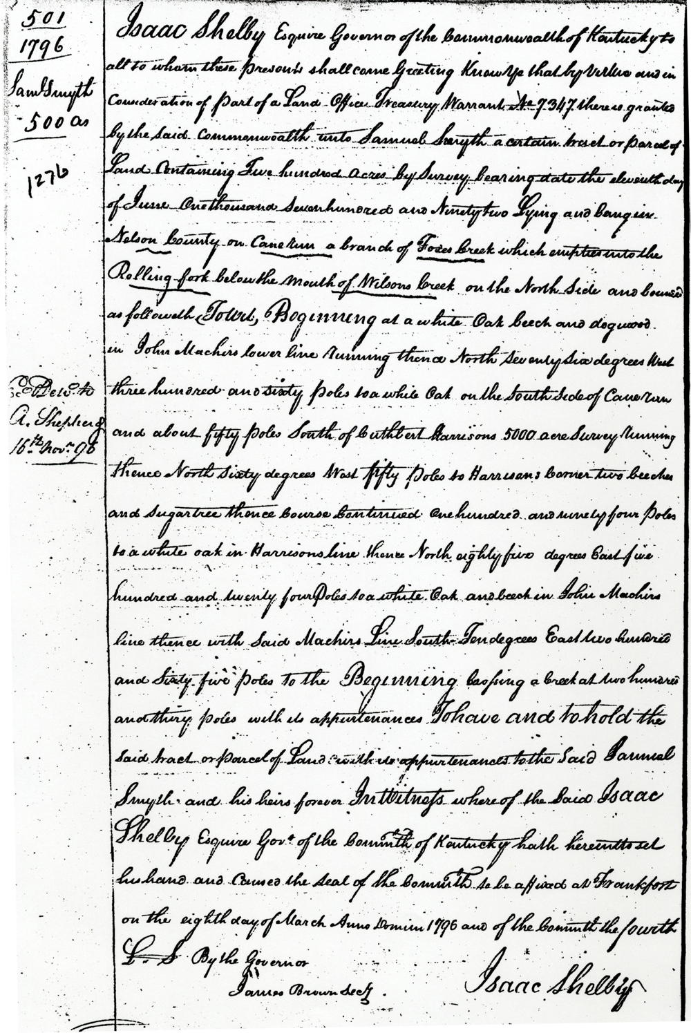
On 11 Jun 1792, Samuel Smyth surveyed 500 acres for himself on the waters of Cane Run in present-day southern Bullitt County. It is helpful that, in the survey description, Smyth identifies that Cane Run empties into Fox Creek which empties into Rolling Fork, thus helping us determine that Fox Creek was an early name for present-day Crooked Creek. The survey and deed are shown below along with their transcriptions.
Survey
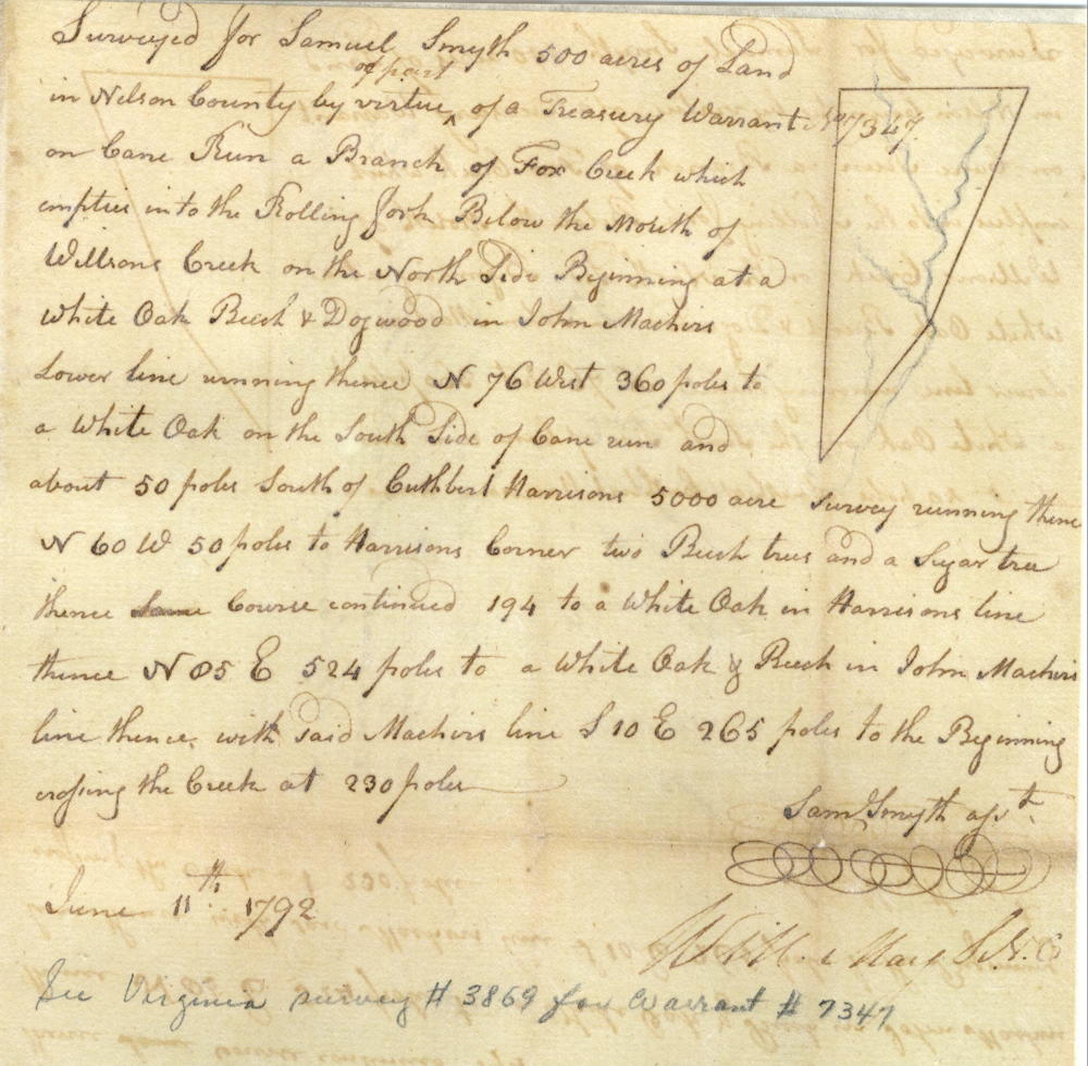
Surveyed for Samuel Smyth 500 acres of land in Nelson County by virtue of part of a treasury warrant No. 7347 on Cane run a branch of Fox Creek which empties into the Rolling Fork below the mouth of Wilson's Creek on the north side. Beginning at white oak, beech and dogwood in John Machin lower line, running thence N 76° West 360 poles to a white oak on the south side of Cane Rn and about 50 poles south of Cuthbert Harrison's 5000 acre survey, running thence N 60° W 50 poles to Harrison's corner two beech trees and a sugar tree, thence course continued 194 [poles] to a white oak in Harrison's line, thence N 85° E 524 poles to a white oak and beech in John Machin's line, thence with said Machin line S 10° E 265 poles to the beginning, crossing the creek at 230 poles. June 11th 1792. Sam Smyth, surveyor
Deed
If you, the reader, have an interest in any particular part of our county history, and wish to contribute to this effort, use the form on our Contact Us page to send us your comments about this, or any Bullitt County History page. We welcome your comments and suggestions. If you feel that we have misspoken at any point, please feel free to point this out to us.
The Bullitt County History Museum, a service of the Bullitt County Genealogical Society, is located in the county courthouse at 300 South Buckman Street (Highway 61) in Shepherdsville, Kentucky. The museum, along with its research room, is open 10 a.m. to 4 p.m. Monday through Friday. Saturday appointments are available by calling 502-921-0161 during our regular weekday hours. Admission is free. The museum, as part of the Bullitt County Genealogical Society, is a 501(c)3 tax exempt organization and is classified as a 509(a)2 public charity. Contributions and bequests are deductible under section 2055, 2106, or 2522 of the Internal Revenue Code. Page last modified: 12 Jan 2024 . Page URL: bullittcountyhistory.org/bchistory/samuel-smyth-ok1276.html