
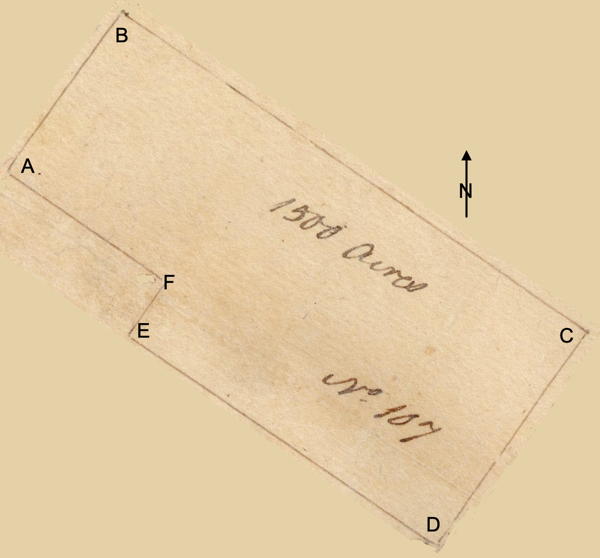
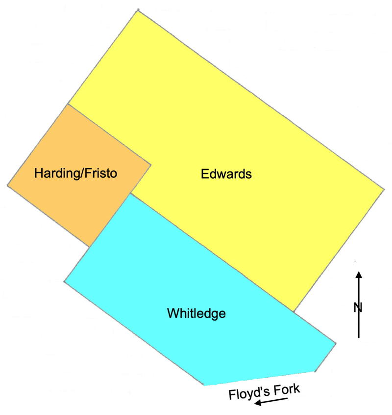
On 19 Dec 1782, John Ray surveyed 1500 acres for John Edwards, land that lay north of Floyd's Fork, and adjoining the 400 acre survey of Thomas Hardin that is shown on James Shanks' 1811 plat drawing. Edwards was able to get a deed to the tract on 5 Jan 1784. He sold 500 acres of it to William Pope in 1788. Then, beginning in 1799, he sold 3 tracts to Samuel Thornsberry. Below is a rotated drawing of the plat on the left, and a drawing showing Edward's tract in relation to those of William Whitledge and Thomas Harding as described in the surveys.
Survey
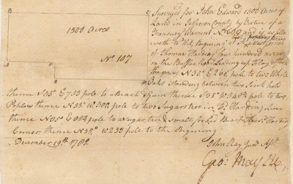
Surveyed for John Edward 1500 acres of land in Jefferson County by virtue of a treasury warrant No. 609, and is as followeth, to wit. Beginning at [A] two poplar trees a west corner of Thomas Harding 400 acres on the buffalo road leading up Floyd's Fork, thence N 35° E 260 poles to [B] two white oaks standing between two sink hole, thence S 55° E 753 poles to [C] a beech & gum, thence S 35° W 348 3/4 poles to [D] two poplars, thence N 55° W 500 poles to [E] two sugar trees in said Harding line, thence N 35° E 88 3/4 poles to [F] a sugar tree & small forked beech tree said Harding corner, thence N 55° W 253 poles to the beginning. December 19th 1782. John Ray, surveyor.
Deed
Virginia Grant Book 1, pages 256-7
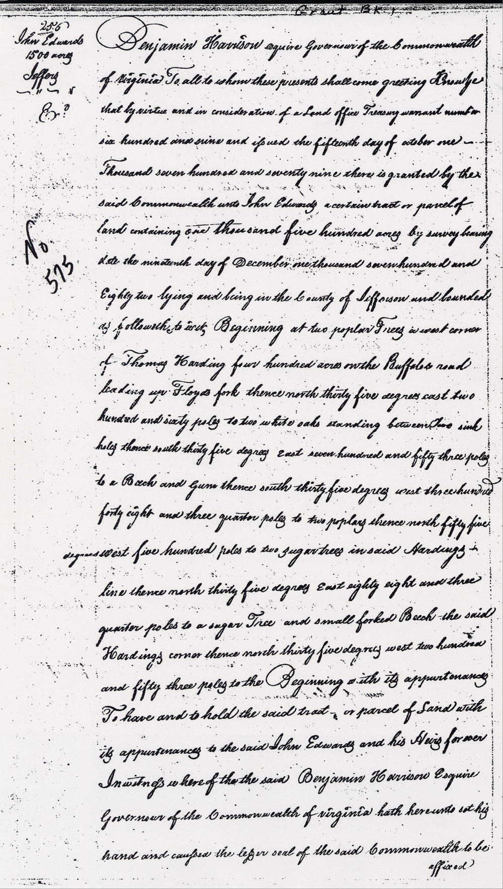
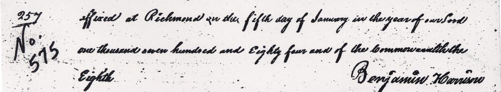
Benjamin Harrison Esquire, governor of the Commonwealth of Virginia, to all to whom these presents shall come, greeting. Know ye that by virtue and in consideration of a land office treasury warrant number 609 and issued the 15th day of October 1779, there is granted by the said Commonwealth unto John Edwards a certain tract or parcel of land containing 1500 acres by survey bearing date the 19th day of December 1782, lying and being in the county of Jefferson and bounded as followeth, to wit. Beginning at two poplar trees a west corner of Thomas Harding 400 acres on the buffalo road leading up Floyd's Fork, thence North 35° East 260 poles to two white oaks standing between two sink hole, thence South 55° East 753 poles to a beech & gum, thence South 35° West 348 3/4 poles to two poplars, thence North 55° West 500 poles to two sugar trees in said Harding line, thence North 35° East 88 3/4 poles to a sugar tree & small forked beech tree the said Harding's corner, thence North 55° West 253 poles to the beginning with its appurtenances. To have and to hold the said tract or parcel of land with its appurtenances to the said John Edwards and his heirs forever. In witness whereof the said Benjamin Harrison Esquire, governor of the Commonwealth of Virginia, hath hereunto set his hand and caused the lesser seal of the said Commonwealth to be affixed at Richmond on the 5th day of January in the year of our Lord 1784, and of the Commonwealth the eighth. (signed) Benjamin Harrison
If you, the reader, have an interest in any particular part of our county history, and wish to contribute to this effort, use the form on our Contact Us page to send us your comments about this, or any Bullitt County History page. We welcome your comments and suggestions. If you feel that we have misspoken at any point, please feel free to point this out to us.
The Bullitt County History Museum, a service of the Bullitt County Genealogical Society, is located in the county courthouse at 300 South Buckman Street (Highway 61) in Shepherdsville, Kentucky. The museum, along with its research room, is open 10 a.m. to 4 p.m. Monday through Friday. Saturday appointments are available by calling 502-921-0161 during our regular weekday hours. Admission is free. The museum, as part of the Bullitt County Genealogical Society, is a 501(c)3 tax exempt organization and is classified as a 509(a)2 public charity. Contributions and bequests are deductible under section 2055, 2106, or 2522 of the Internal Revenue Code. Page last modified: 12 Sep 2024 . Page URL: bullittcountyhistory.org/bchistory/0575-edwards.html