
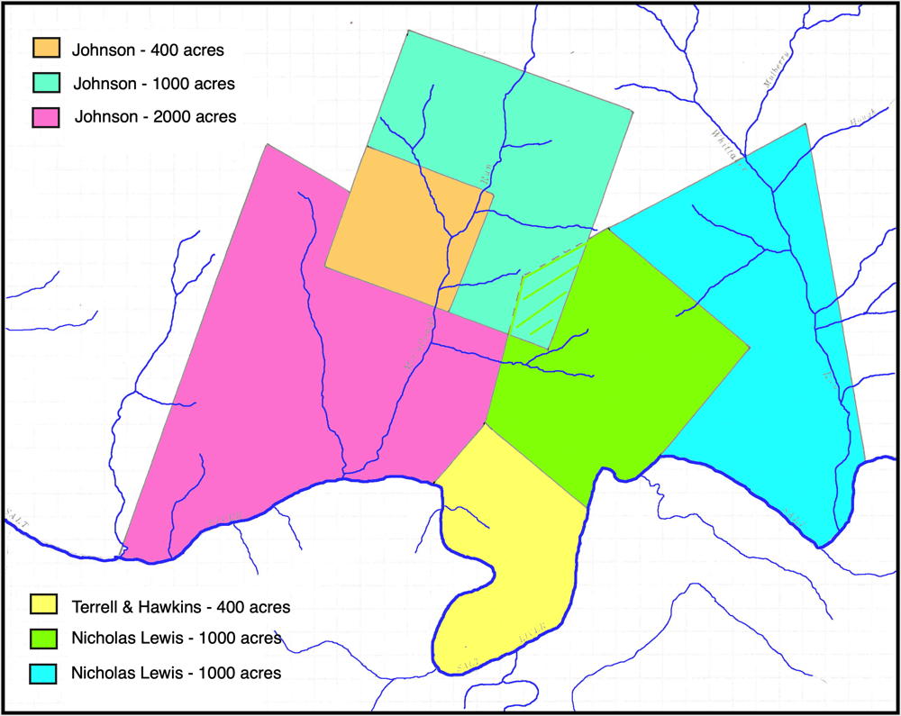
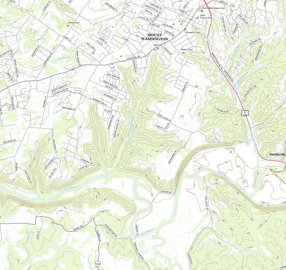
On 12 Mar 1783, Thomas Whitledge surveyed 400 acres on the north side of Salt River, across from the mouth of Cox's Creek, for Samuel Terrell and Martin Hawkins, assignees of David Hawkins. They received their deed on 2 May 1785. The map below shows the approximate location of the Hawkins tract just north of the mouth of Cox's Creek. Also shown are the locations of neighboring tracts north of the river. The second map below is part of topographic maps drawn in 2019 that show the same region This will help you locate these tracts more closely.
Survey
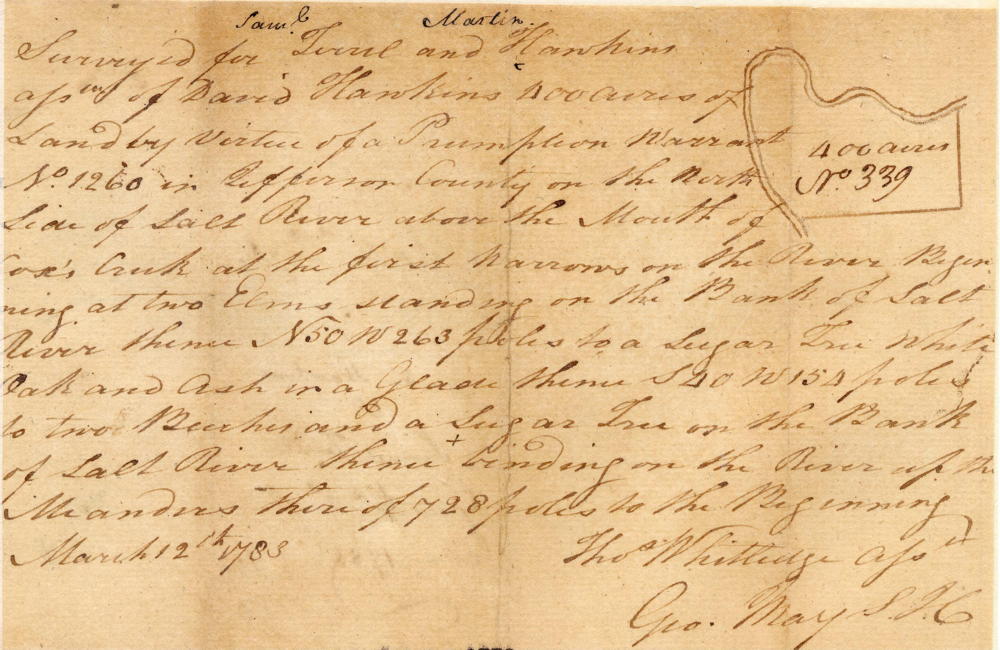
Surveyed for Samuel Terrell and Martin Hawkins, assignees of David Hawkins, 400 acres of land by virtue of a preemption warrant No. 1260 in Jefferson County on the north side of Salt River above the mouth of Cox's Creek at the first narrows on the river. Beginning at two elms standing on the bank of Salt River, thence N 50° W 263 poles to a sugar tree, white oak and ash in a glade, thence S 40° W 154 poles to two beeches and a sugar tree on the bank of Salt River, thence binding on the river up the meanders thereof 728 poles to the beginning. March 12th 1783. Thomas Whitledge, surveyor.
Deed
Virginia Grant Book 3, page 149
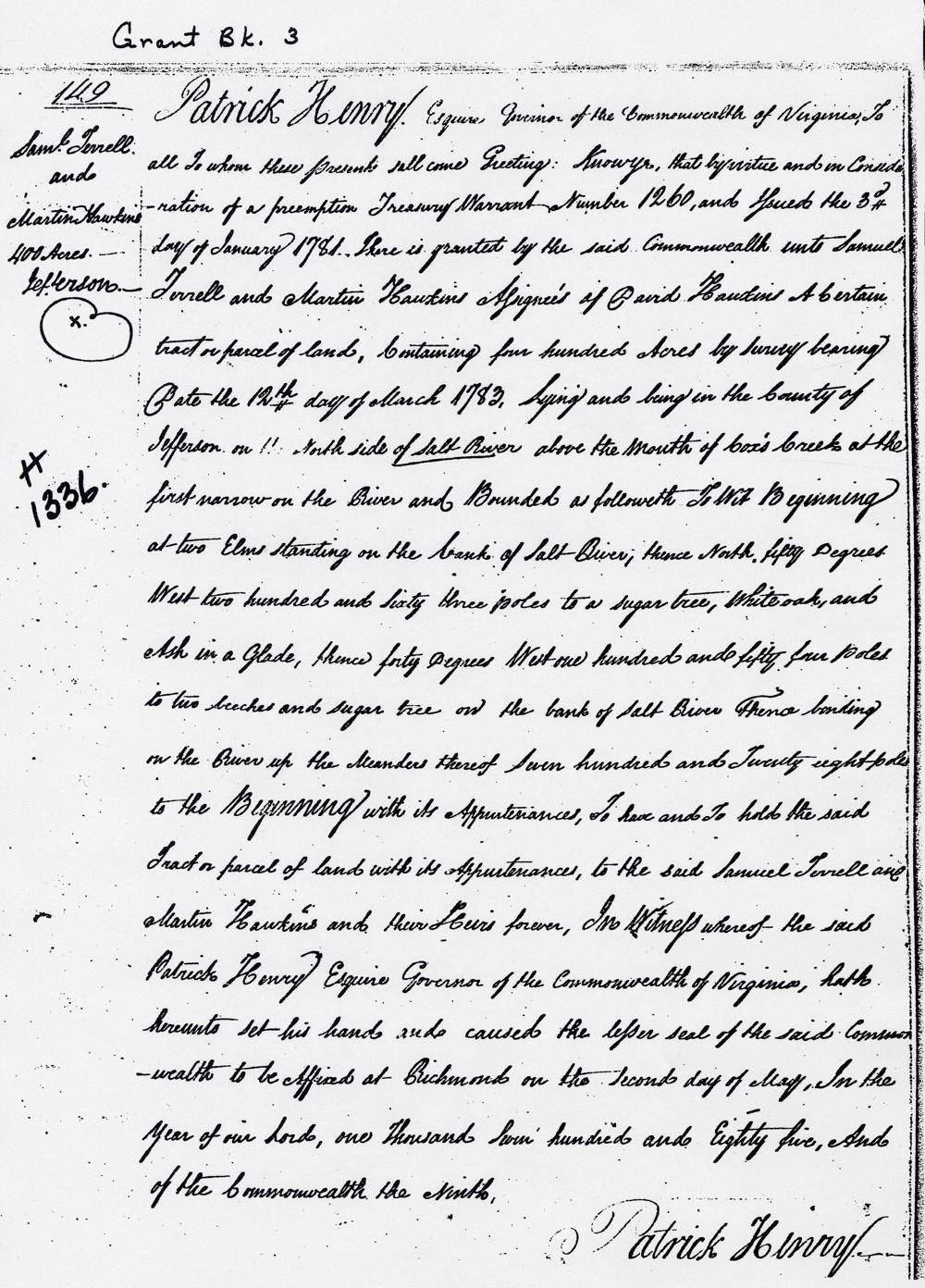
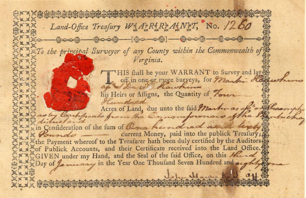
Patrick Henry Esquire, Governor of the Commonwealth of Virginia, to all to whom these presents shall come, greeting. Know ye that by virtue and in consideration of a preemption treasury warrant number 1260 and issued the third day of January 1781 there is granted by the said Commonwealth onto Samuel Terrell and Martin Hawkins, assignees of David Hawkins, a certain tract or parcel of land containing 400 acres by survey bearing date the 12th day of March 1783, lying and being in the county of Jefferson on the north side of Salt River above the mouth of Cox's Creek at the first narrow on the river and bounded as followeth, to wit. Beginning at two elms standing on the bank of Salt River, thence North 50° West 263 poles to a sugar tree, white oak and ash in a glade, thence [South] 40° West 154 poles to two beeches and a sugar tree on the bank of Salt River, thence binding on the river up the meanders thereof 728 poles to the beginning with its appurtenances. To have and to hold the said tract or parcel of land with its appurtenances, to the said Samuel Terrell and Martin Hawkins and their heirs forever. In witnesses whereof the said Patrick Henry Esquire, Governor of the Commonwealth of Virginia, hath hereunto set his hand and caused the lesser seal of the said Commonwealth to be affixed at Richmond on the second day of May in the year of our Lord 1785, and of the Commonwealth the 9th. (signed) Patrick Henry
Warrant
If you, the reader, have an interest in any particular part of our county history, and wish to contribute to this effort, use the form on our Contact Us page to send us your comments about this, or any Bullitt County History page. We welcome your comments and suggestions. If you feel that we have misspoken at any point, please feel free to point this out to us.
The Bullitt County History Museum, a service of the Bullitt County Genealogical Society, is located in the county courthouse at 300 South Buckman Street (Highway 61) in Shepherdsville, Kentucky. The museum, along with its research room, is open 10 a.m. to 4 p.m. Monday through Friday. Saturday appointments are available by calling 502-921-0161 during our regular weekday hours. Admission is free. The museum, as part of the Bullitt County Genealogical Society, is a 501(c)3 tax exempt organization and is classified as a 509(a)2 public charity. Contributions and bequests are deductible under section 2055, 2106, or 2522 of the Internal Revenue Code. Page last modified: 12 Sep 2024 . Page URL: bullittcountyhistory.org/bchistory/1336-hawkins.html