
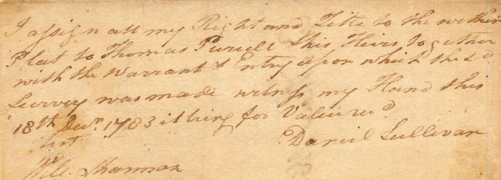
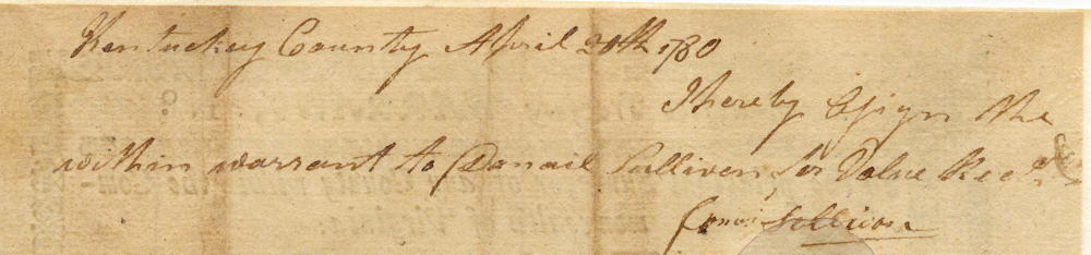
On 26 Feb 1783, Sam Smyth surveyed 400 acres for Daniel Sullivan "lying on Crooked Run, a branch of Fox Creek which empties into the Rolling Fork of Salt River." Today Fox Creek goes by the name of Crooked Creek, and is located in southern Bullitt County. Daniel Sullivan had received a treasury warrant from James Sullivan which he used for this survey. He then assigned the survey to Thomas Purcell, who received a deed to this tract on 2 Dec 1785.
On 5 Jul 1805, Thomas Purcell deeded the 400 acres to his son John Purcell.
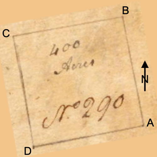
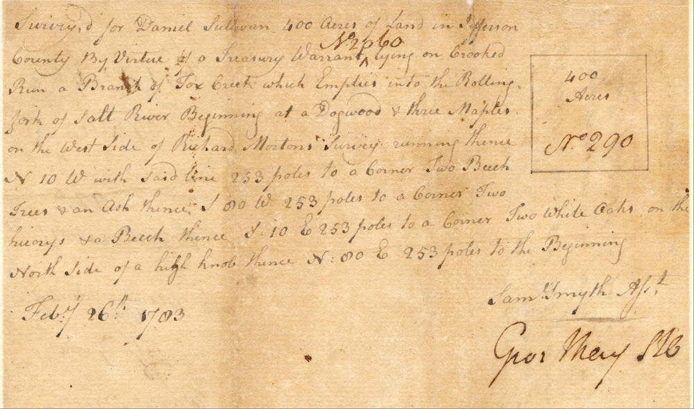
Survey
Surveyed for Daniel Sullivan 400 acres of land in Jefferson County by virtue of a treasury warrant number 2060 lying on Crooked Run, a branch of Fox Creek which empties into the Rolling Fork of Salt River. Beginning at [A] a dogwood and three maples on the west side of Richard Morton's survey, running thence North 10° West with said line 253 poles to [B] a corner to beech trees and an ash thence South 80° West 253 poles to [C] a corner two hickories and a beech, thence South 10° East 253 poles to [D] a corner two white oaks on the north side of a high knob, thence North 80° East 253 poles to the beginning. February 26th 1783. Sam Smyth, surveyor.
Deed
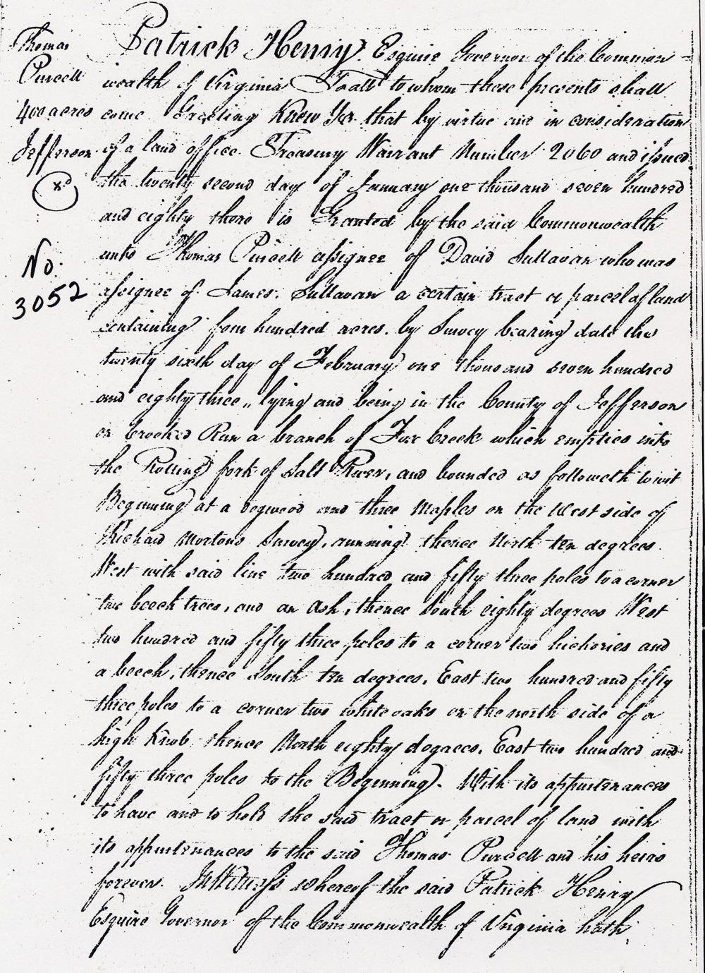
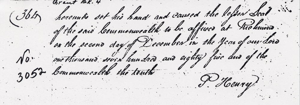
Virginia Grant Book 4, pages 363-4
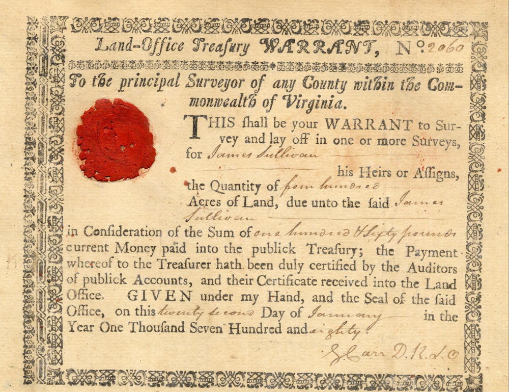
Patrick Henry Esquire, governor of the Commonwealth of Virginia, to all to whom these presents shall come, greeting. Know ye that by virtue and in consideration of a land office treasury warrant number 2060 issued the 22nd day of January 1780 there is granted by the said Commonwealth unto Thomas Purcell, assignee of Daniel Sullivan who was assignee of James Sullivan, a certain tract or parcel of land containing 400 acres by survey bearing date the 26th day of February 1783, lying and being in the county of Jefferson on Crooked Run, a branch of Fox Creek which empties into the Rolling Fork of Salt River on the north side of Daniel Sullivan's survey of 400 acres, and bounded as followeth, to wit. Beginning at a dogwood and three maples on the west side of Richard Morton's survey, running thence North 10° West with said line 253 poles to a corner to beech trees and an ash thence South 80° West 253 poles to a corner two hickories and a beech, thence South 10° East 253 poles to a corner two white oaks on the north side of a high knob, thence North 80° East 253 poles to the beginning with its appurtenances to have and to hold the said tract or parcel of land with its appurtenances to the said Thomas Purcell and his heirs forever. In witness whereof the said Patrick Henry Esquire, Governor of the Commonwealth of Virginia hath hereunto set his hand and caused the lesser seal of the said Commonwealth to be affixed at Richmond on the second day of December in the year of our Lord 1785, and of the Commonwealth the 10th. (signed) P. Henry
Warrant
If you, the reader, have an interest in any particular part of our county history, and wish to contribute to this effort, use the form on our Contact Us page to send us your comments about this, or any Bullitt County History page. We welcome your comments and suggestions. If you feel that we have misspoken at any point, please feel free to point this out to us.
The Bullitt County History Museum, a service of the Bullitt County Genealogical Society, is located in the county courthouse at 300 South Buckman Street (Highway 61) in Shepherdsville, Kentucky. The museum, along with its research room, is open 10 a.m. to 4 p.m. Monday through Friday. Saturday appointments are available by calling 502-921-0161 during our regular weekday hours. Admission is free. The museum, as part of the Bullitt County Genealogical Society, is a 501(c)3 tax exempt organization and is classified as a 509(a)2 public charity. Contributions and bequests are deductible under section 2055, 2106, or 2522 of the Internal Revenue Code. Page last modified: 12 Sep 2024 . Page URL: bullittcountyhistory.org/bchistory/3052-purcell.html