
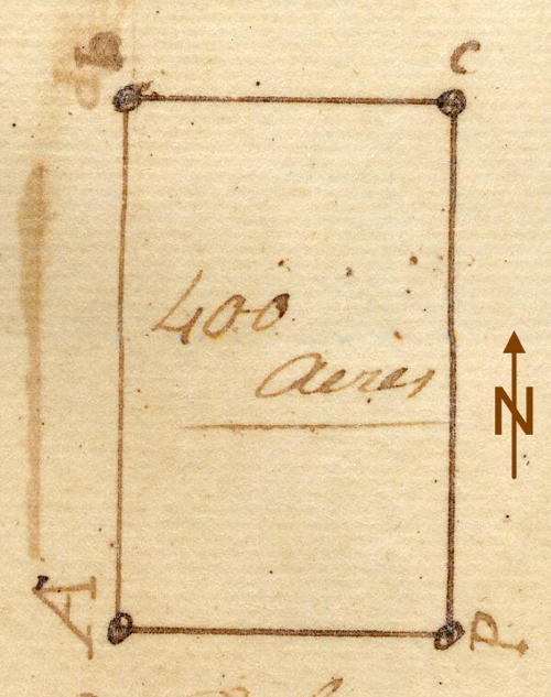
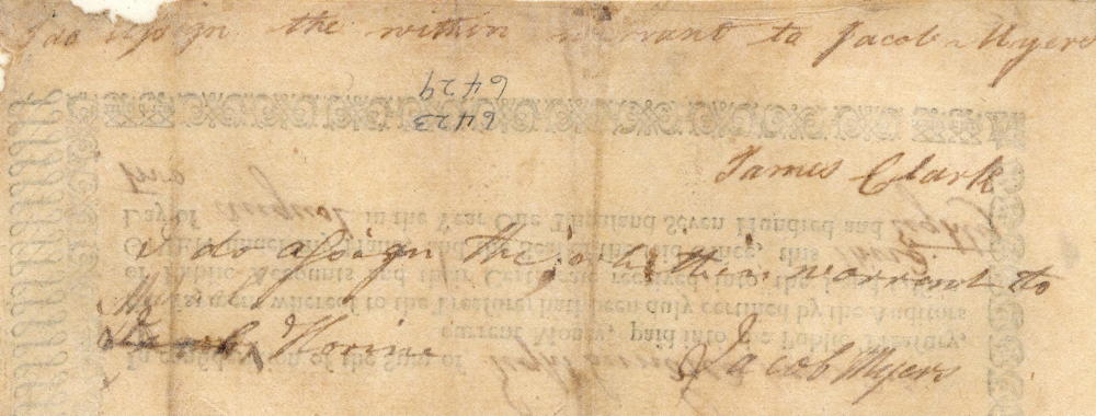
On 5 Jul 1784, Baker Ewing led a survey team that surveyed 400 acres for Michael Horine that lay on a dividing ridge that leads from Salt River up to the "Bald Hills" which are about 2,5 miles from Bullitt's Lick. The survey was based on a treasury warrant originally issued to James Clark, who signed it over to Jacob Myers who then assigned it to Michael Horine who received his deed for this tract on 31 Aug 1787. The drawing shown here has been rotated to correct its orientation.
Survey
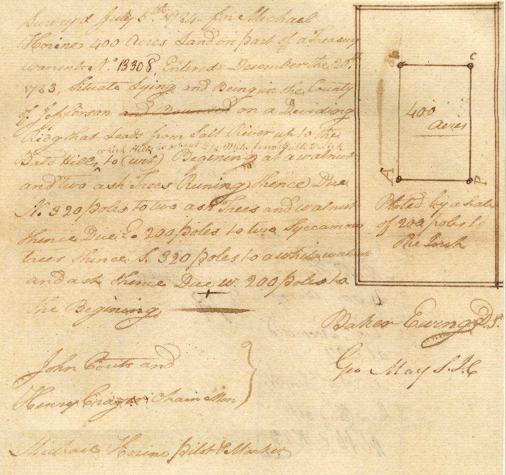
Surveyed July 5th 1784 for Michael Horine 400 acres land on part of a treasury warrant No. 13308, entered December the 20th 1783, situate lying and being in the county of Jefferson on a dividing ridge that leads from Salt River up to the Bald Hills which hills is about 2 1/2 miles from Bullitt's Lick, to wit. Beginning at a walnut and two ash trees, running thence due North 320 poles to two ash trees and walnut, thence due East 200 poles to two sycamore trees, thence South 320 poles to a white walnut and ash, thence due West 200 poles to the beginning. Baker Ewing, surveyor. John Couts and Henry Crager, chain men. Michael Horine, pilot & marker.
Deed
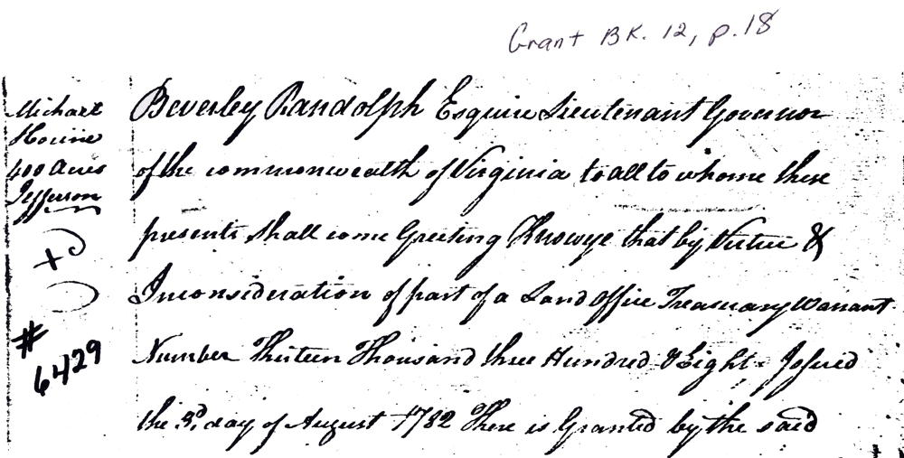
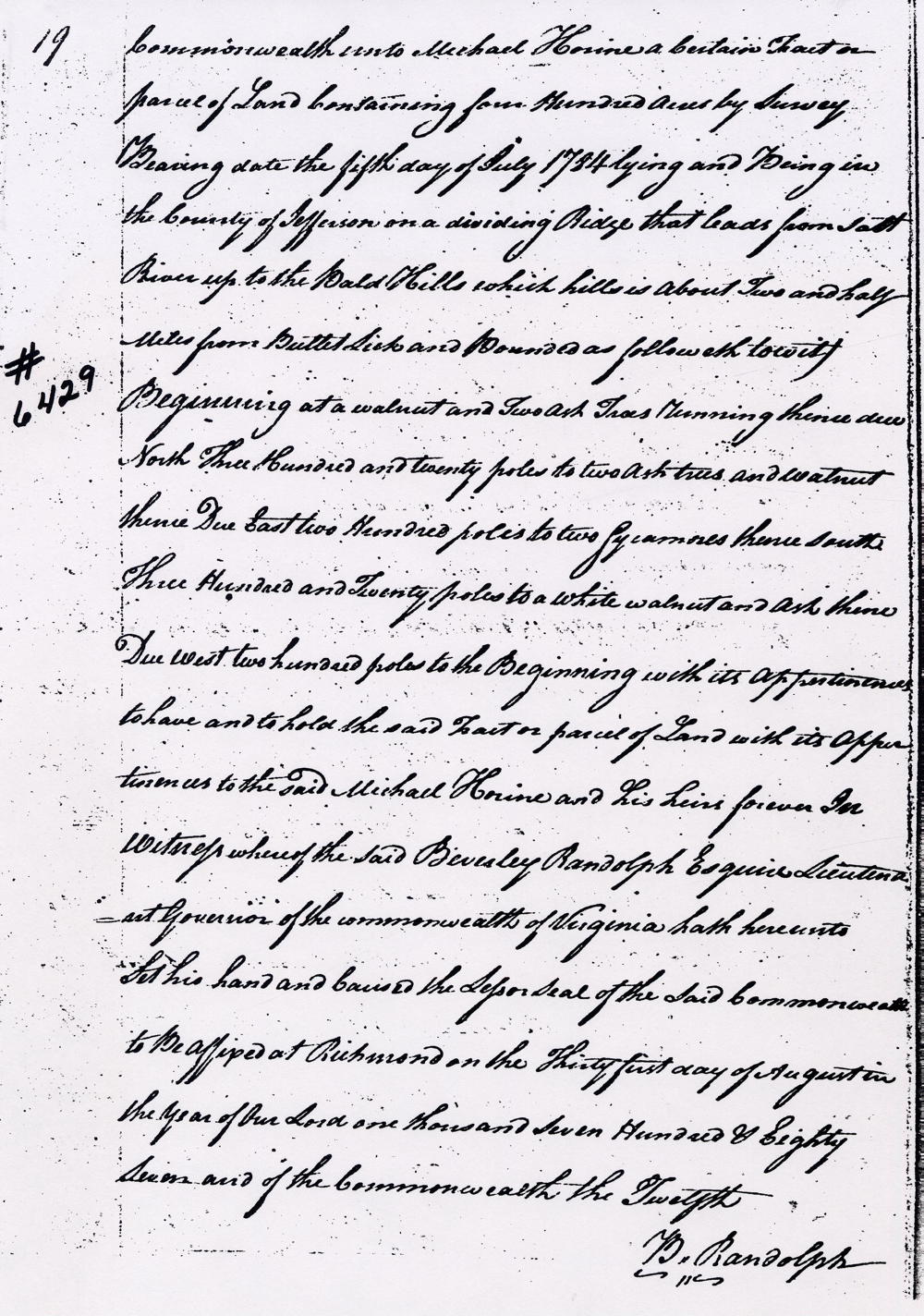
Virginia Grant Book 12, pages 18-19
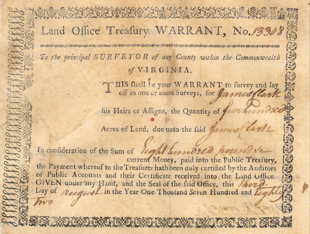
Beverly Randolph Esquire, Lieutenant Governor of the Commonwealth of Virginia. To all to whom these presents shall come, greeting. Know ye that by virtue and in consideration of part of a land office treasury warrant numbers 13308 issued the 3rd day of August 1782, there is granted by the said Commonwealth unto Michael Horine a certain tract or parcel of land containing 400 acres by survey bearing date the 5th day of July 1784, lying and being in the county of Jefferson on a dividing ridge that leads from Salt River to the bald hills which said hills is about two and a half miles from Bullitt's Lick & bounded as followeth, to wit. Beginning at a walnut and two ash trees, running thence due North 320 poles to two ash trees and walnut, thence due East 200 poles to two sycamore trees, thence South 320 poles to a white walnut and ash, thence due West 200 poles to the beginning. with its appurtenances to have and to hold the said tract or parcel of land with its appurtenances to the said Michael Horine and his heirs forever. In witness whereof the said Beverly Randolph Esquire, Lieutenant Governor of the Commonwealth of Virginia, hath hereunto set his hand and caused the lesser seal of the said Commonwealth to be affixed at Richmond on the 31st day of August in the year of our Lord 1787, and of the Commonwealth the 12th. (signed) B. Randolph
Warrant
If you, the reader, have an interest in any particular part of our county history, and wish to contribute to this effort, use the form on our Contact Us page to send us your comments about this, or any Bullitt County History page. We welcome your comments and suggestions. If you feel that we have misspoken at any point, please feel free to point this out to us.
The Bullitt County History Museum, a service of the Bullitt County Genealogical Society, is located in the county courthouse at 300 South Buckman Street (Highway 61) in Shepherdsville, Kentucky. The museum, along with its research room, is open 10 a.m. to 4 p.m. Monday through Friday. Saturday appointments are available by calling 502-921-0161 during our regular weekday hours. Admission is free. The museum, as part of the Bullitt County Genealogical Society, is a 501(c)3 tax exempt organization and is classified as a 509(a)2 public charity. Contributions and bequests are deductible under section 2055, 2106, or 2522 of the Internal Revenue Code. Page last modified: 12 Sep 2024 . Page URL: bullittcountyhistory.org/bchistory/6429-horine.html