
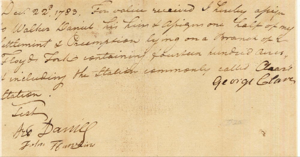
George Clear built one or more cabins along a steam that bears his name, sometime in or before 1781. However, he apparently didn't get around to having land surveyed for about two years. Clear ended up losing most of the 3 tracts described here to Robert Shanklin whose claim was judged superior. George Clear signed over half his claims to Walker Daniel on 22 Dec 1783, and left the area, moving to Ohio.
This survey was #10 on the 1811 plat drawing by James Shanks, Bullitt County Surveyor, which is described on another page. Shanks indicated that Joseph Brooks had obtained the southeast tract by that time.
A Google map showing the suspected location of Clear's surveys is available on another page here.
The drawing shows the following three tracts together. Inserted in the upper right are images of the original survey drawings, rotated to match the correct directions.
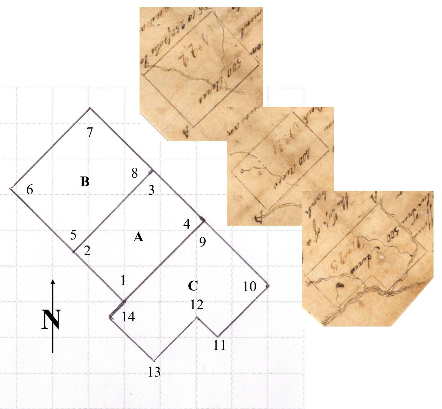
A. George Clear Settlement Tract - 400 acres; surveyed 12 Mar 1783 by John Handley and George May.
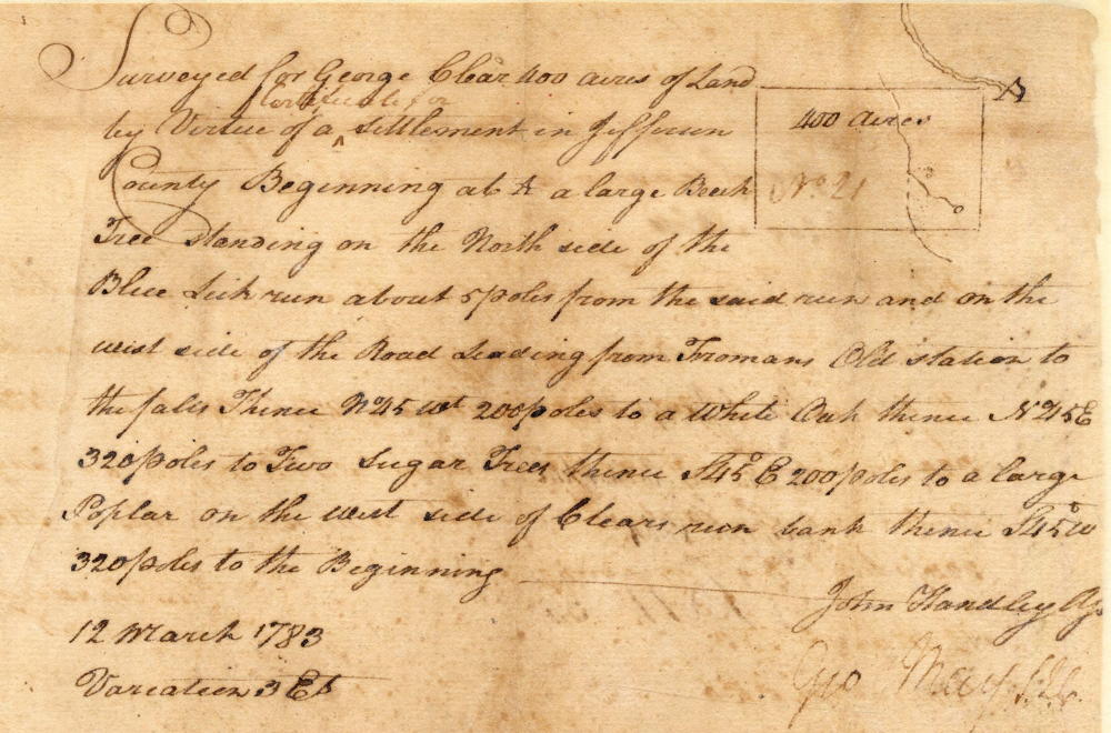
Surveyed for George Clear 400 acres of land by virtue of a certificate for settlement in Jefferson County beginning [1] at a large Beech tree standing on the north side of the Blue Lick Run about 5 poles from the said run and on the west side of the road leading from Fromans Old Station to the Falls, thence N 45 W 200 poles to a [2] white oak, thence N 45 E 320 poles to [3] two sugar trees, thence S 45 E 200 poles to [4] a large poplar on the west side of Clears Run bank, thence S 45 W 320 poles to the beginning.
B. George Clear 500 acre tract, northwest of his settlement tract; surveyed 12 Mar 1783 by John Handley and George May.
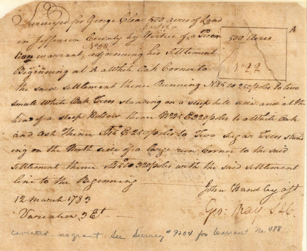
Surveyed for George Clear 500 acres of land in Jefferson County part of in virtue of a treasury warrant No 88 adjoining his settlement; beginning at [5] a white oak corner to the said settlement, thence running N 45 W 250 poles to [6] two small white oak trees standing on a steep hill side and at the head of a steep hollow, thence N 45 E 320 poles to [7] a white oak and ash, thence S 45 E 250 poles to [8] two sugar trees standing on the north side of a large run corner to the said settlement, thence S 45 W 320 poles with the said settlement line to the beginning.
C. George Clear 500 acre tract, southeast of his settlement tract; surveyed 12 Mar 1783 by John Handley and George May.
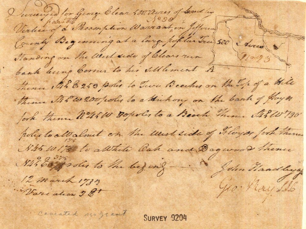
Surveyed for George Clear 500 acres of land by virtue of part of a preemption warrant No. 88 in Jefferson County, beginning at [9] a large poplar tree standing on the west side of Clear Run bank being corner to his settlement, thence S 45 E 253 poles to [10] two beeches on the top of a hill, thence S 45 W 200 poles to [11] a hickory on the bank of Floyds Fork, thence N 45 W 80 poles to [12] a Beech, thence S 45 W 180 poles to [13] a Walnut on the west side of Floyds Fork, thence N 45 W 175 to [14] a White Oak and Dogwood, thence N 45 E 375 poles to the beginning.
Surveys
If you, the reader, have an interest in any particular part of our county history, and wish to contribute to this effort, use the form on our Contact Us page to send us your comments about this, or any Bullitt County History page. We welcome your comments and suggestions. If you feel that we have misspoken at any point, please feel free to point this out to us.
The Bullitt County History Museum, a service of the Bullitt County Genealogical Society, is located in the county courthouse at 300 South Buckman Street (Highway 61) in Shepherdsville, Kentucky. The museum, along with its research room, is open 10 a.m. to 4 p.m. Monday through Friday. Saturday appointments are available by calling 502-921-0161 during our regular weekday hours. Admission is free. The museum, as part of the Bullitt County Genealogical Society, is a 501(c)3 tax exempt organization and is classified as a 509(a)2 public charity. Contributions and bequests are deductible under section 2055, 2106, or 2522 of the Internal Revenue Code. Page last modified: 12 Sep 2024 . Page URL: bullittcountyhistory.org/bchistory/clear_plats.html