
According to Robert McDowell, "William Farmer's 700 acres on Salt River opposite the mouth of Long Lick Creek was entered 29 Jun 1780." We have been able to locate this entry. Nicholas Meriwether obtained Farmer's right to the land. He is recorded as authorizing Captain Ben Roberts to sell "a tract of land on Salt River, location in the name of William Farmer adjoining Col. Christian's survey on Bullitt's Lick" on 17 May 1791. This was recorded on page 141 in the Jefferson County Calendar of Bond and Power of Attorney, Book No. 1, on 3 Apr 1792. ["Calendar of Bond and Power of Attorney, Book No. 1, Jefferson County, Kentucky, 1783-1798" by Ludie J. Kinkead and Katharine G. Healy, Filson Club Quarterly, Volume 7, April 1932, page 105.]
On 20 Sep 1795, Philip Buckner of Mason County, Kentucky signed a deed to sell part of it to Jonathan Irons, as shown in the transcription of this Jefferson County deed below, which also identifies this as the Fort Nonsense tract.
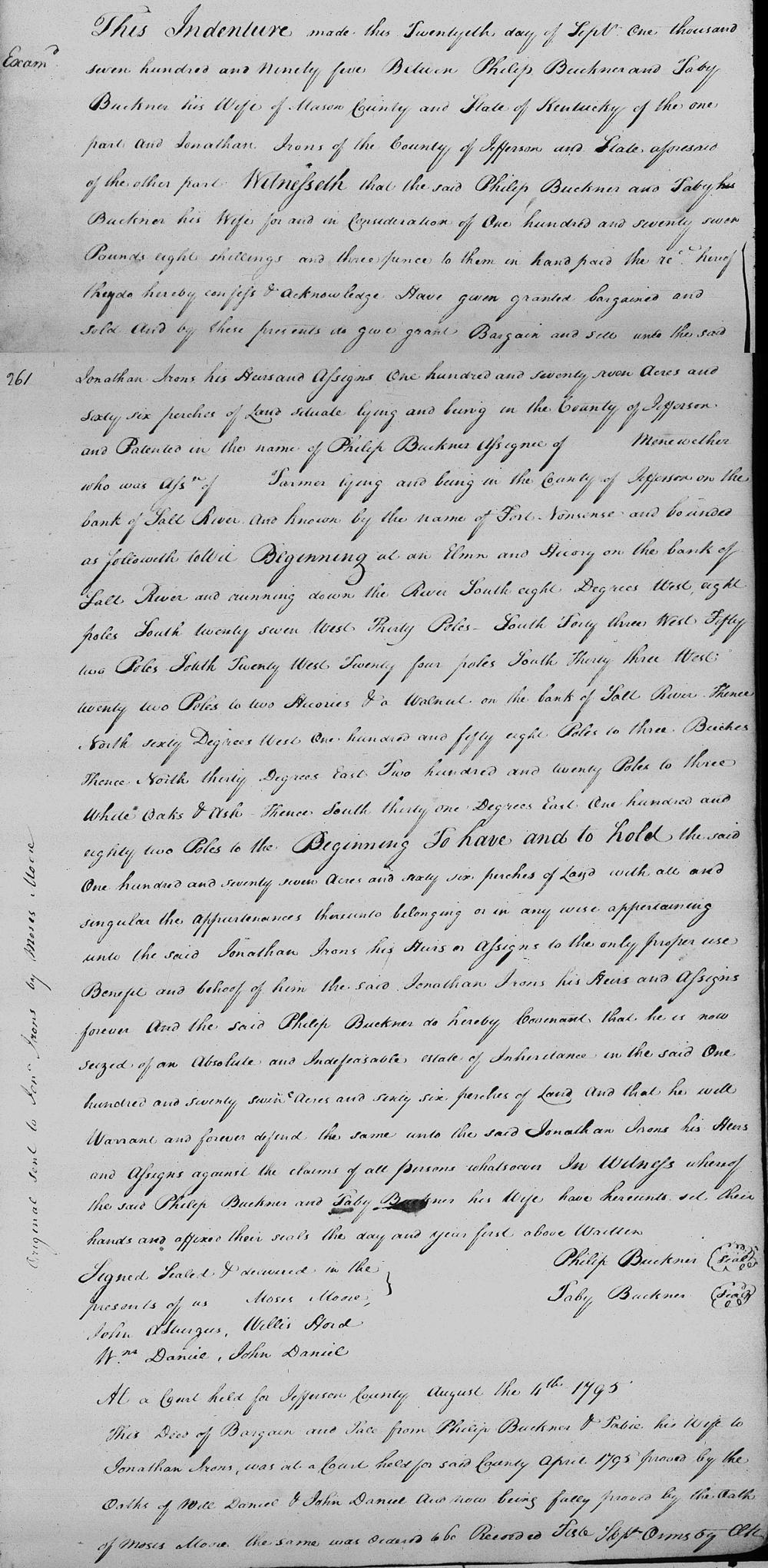
Jefferson County Deed Book 4, Pages 260-261
This indenture made this 20th day of September 1795 between Philip Buckner and Taby Buckner his wife of Mason County and state of Kentucky the one part and Jonathan Irons of the county of Jefferson and State aforesaid of the other part. Witnesseth that the said Philip Buckner and Taby Buckner his wife for and in consideration of 177 pounds, eight shillings, and 3 pence to them in hand paid, the receipt hereof they do hereby confess and acknowledge, have given, granted, bargained and sold and by these presents do give, grant, bargain and sell unto to said Jonathan Irons his heirs and assigns 177 acres and 66 perches of land situate lying and being in the county of Jefferson and patented in the name of Philip Buckner assignee of __ Meriweather who was assigne of __ Farmer lying and being in the county of Jefferson on the bank of Salt River and known by the name of Fort Nonsense and bounded as followeth to wit. Beginning at an elm and hickory on the bank of Salt River and running down the river South 8° West 8 poles, South 27° West 30 poles, South 43° West 52 poles, South 20° West 24 poles, South 33° West 22 poles to two hickorys and a walnut on the bank of Salt River, thence North 60° West 158 poles to three beeches, thence North 30° East 220 poles to three white oaks and ash, thence South 31° East 182 poles to the beginning to have and to hold the sea at 177 acres and 66 perches of land with all and singular the appurtenances thereunto belonging or in any wise appertaining unto the said Jonathan Irons, his heirs or assigns, to the only proper use, benefit and behoof of him the said Jonathan Irons, his heirs and assigns forever. And the said Philip Buckner do hereby covenant that he is now seized of a absolute and indefeasable estate of inheritance in the said 177 acres and 66 perches of land and that he will warrant and forever defend the same unto the said Jonathan Irons, his heirs and assigns, against the claims of all persons whatsoever. In witness whereof the said Philip Buckner and Taby Buckner his wife have hereunto set their hands and affixed their seal the day and year first above written. (signed) Philip Buckner, Taby Buckner. Signed, sealed and delivered in the presence of us: Moses Moore, John A. Sturgus, Willis Hord, Wm Daniel, John Daniel.
Three years later, on 29 Nov 1798, a second deed from Buckner to Irons was entered in Bullitt County. It apparently covered the same tract of land, but changed the number of acres sold from "177 acres and 66 perches" to "191 1/2 acres" of land. Transcription of this deed is shown below, followed by images of both deeds.
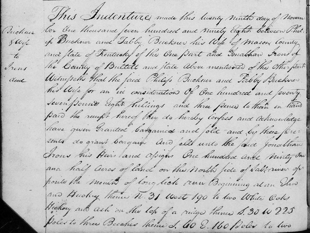
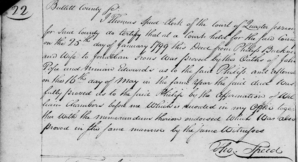
Bullitt County Deed Book A1, Pages 20-22
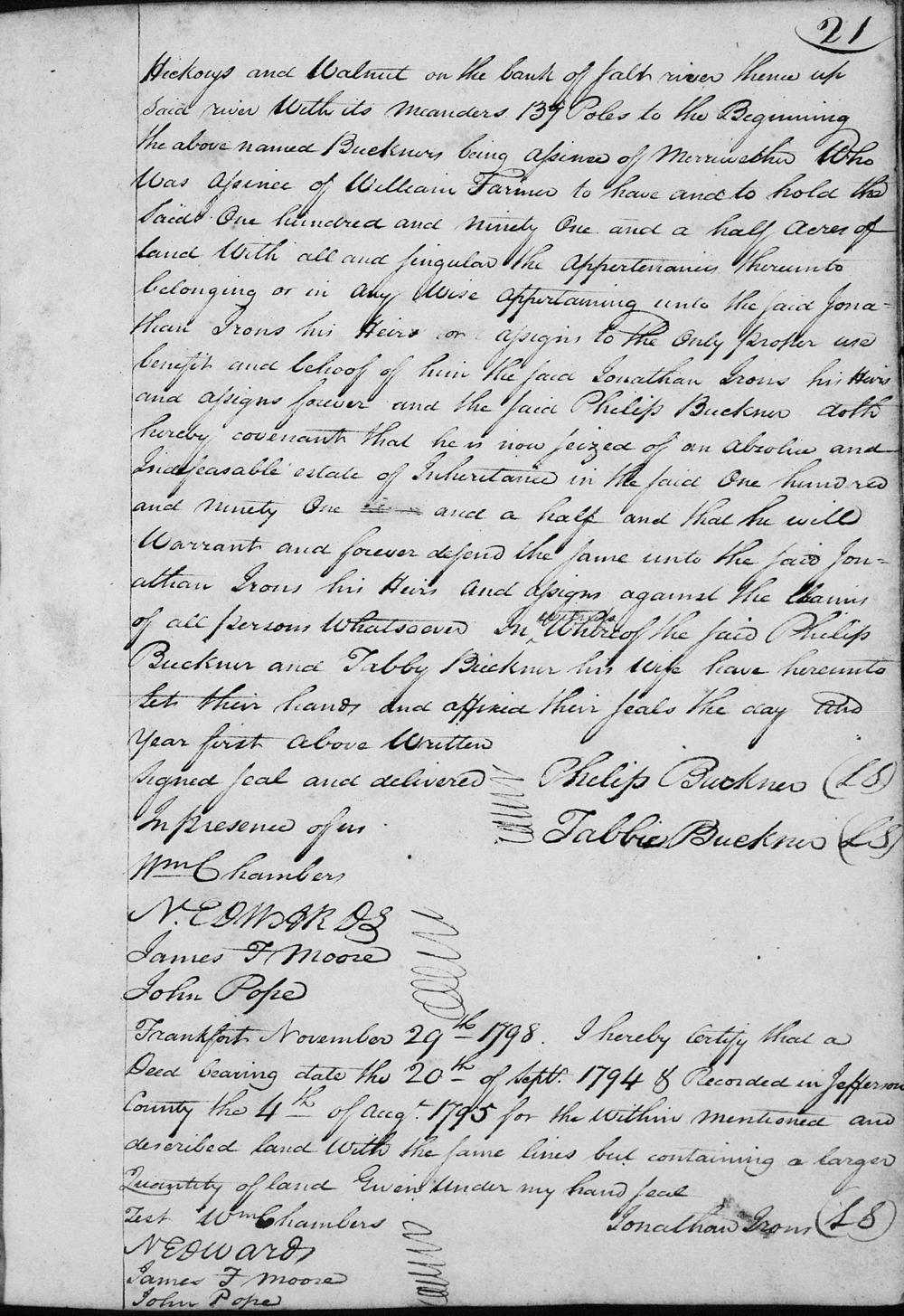
This indenture made this 29th day of November 1798 between Philip Buckner and Tabby Buckner his wife of Mason County and state of Kentucky of the one part and Jonathan Irons of the county of Bullitt and state above mentioned of the other part. Witnesseth that they the said Philip Buckner and Tabby Buckner his wife for and in consideration of 177 pounds eight shillings and three pence to them in hand paid, the receipt hereof they do hereby confess and acknowledge, have given, granted, bargained and sold, and by these presents do grant, bargain and sell onto the said Jonathan Irons, his heirs and assigns, 191 1/2 acres of land on the north side of Salt River opposite the mouth of Long Lick Run. Beginning at an elm and hickory, thence North 31° West 190 poles to two white oaks, hickory and ash on the top of the ridge, thence South 30° West 225 poles to three beeches, thence South 60° East 160 poles to two hickorys and walnut on the bank of Salt River, thence up said river with its meanders 137 poles to the beginning. The above named Buckners being assignes of Meriwether who was assigne of William Farmer to have and to hold the said 191 1/2 acres of land with all and singular the appurtenances thereunto belonging or in any wise appertaining unto the said Jonathan Irons, his heirs or assigns to the only proper use, benefit and behoof of him the said Jonathan Irons, his heirs and assigns forever, and the said Philip Buckner doth hereby covenant that he is now seized of a absolute and indefeasable estate of inheritance in the said 191 1/2 acres and that he will warrant and forever defend the same unto the said Jonathan Irons, his heirs and assigns, against the claims of all persons whatsoever. In witness whereof the said Philip Buckner and Tabby Buckner his wife have hereunto set their hands and affixed their seal the day and year first above written. (signed) Philip Buckner, Tabbie Buckner. Signed, sealed and delivered in presence of us: Wm Chambers, Ned Wards, James F. Moore, John Pope.
Frankfort, November 29th 1798. I hereby certify that a deed bearing date the 20th of September 1794 & recorded in Jefferson County the 4th of August 1795 for the within mentioned and described land with the same lines but containing a larger quantity of land. Given under my hand, seal. (signed) Jonathan Irons. Teste: Ned Ward, James F. Moore, John Pope.
If you, the reader, have an interest in any particular part of our county history, and wish to contribute to this effort, use the form on our Contact Us page to send us your comments about this, or any Bullitt County History page. We welcome your comments and suggestions. If you feel that we have misspoken at any point, please feel free to point this out to us.
The Bullitt County History Museum, a service of the Bullitt County Genealogical Society, is located in the county courthouse at 300 South Buckman Street (Highway 61) in Shepherdsville, Kentucky. The museum, along with its research room, is open 10 a.m. to 4 p.m. Monday through Friday. Saturday appointments are available by calling 502-921-0161 during our regular weekday hours. Admission is free. The museum, as part of the Bullitt County Genealogical Society, is a 501(c)3 tax exempt organization and is classified as a 509(a)2 public charity. Contributions and bequests are deductible under section 2055, 2106, or 2522 of the Internal Revenue Code. Page last modified: 12 Sep 2024 . Page URL: bullittcountyhistory.org/bchistory/buckner-irons.html